September 24, 2013
I have created an decent thumbnail page that will take you to 88 of ~ 580 saga pictures. Saga Pictures
September 22, 2013
We are back!
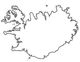
A GPS map of most of our travels. Cummulative Travels
Pictures from September 8, 2013
Standing on the continental rift at Thingvellir. North America on your left, Europe on your right. Low-res Rift
High-res Rift
Wishing for a safe trip at Thingvellir. Low-res Wish
High-res Wish
Monsters butting heads at Thingvellir. Low-res Head Butt
High-res Head Butt
This part of our trip is missing from the GPS recording. We went East from Reykjavik via 1 and 36 to Thingvellir and then on to Laugarvatn. We then ran around from
Laugarvatn for a couple of days before our glacial run North. Laug and its variations mean hot springs, vatn means water and lake.
Pictures from September 9, 2013 (Hawk Day)
Eruption of the geyser Strokkur. Low-res Eruption
High-res Eruption
Gullfoss. Gull means gold and foss means falls. Low-res Gulfoss
High-res Gullfoss
Most of the best pictures of Gulfoss were taken by Amy's phone this day. I wore down the battery in our VCR/Camera trying to get a movie of
Strokkur erupting. We did get the Ace erupting, and it was really a pretty awesome day.
Pictures from September 11, 2013
Stopped at the headwaters of Hvita by a sheep drive. Low-res Baaa
High-res Baaa
Rewarded by a sun illuminated view of Langjokull after driving through driving rain and fog to an elevation of 2277 feet. Low-res Glacier
High-res Glacier
The vehicle that we drove between glaciers in. I think that it was dirtier than it looks. Low-res X-Trail
High-res X-Trail
Supper in Skagastrond after our glacial journey. Low-res Supper
High-res Supper

